Cargando...
Recursos educativos
-
Nivel educativo
-
Competencias
-
Tipología
-
Idioma
-
Tipo de medio
-
Tipo de actividad
-
Destinatarios
-
Tipo de audiencia
-
Creador
Lo más buscado
- fichas inglés
- Percepción visual
- Juegos educativos para educación primaria
- Repaso de lengua castellana para primero
- Dibujos con colores primarios
- Ser y estar
- Múltiplos de 3
- Experimentos con globos educación primaria
- Actividades de lectoescritura en tercero
- La República romana
- El Lazarillo de Tormes
- Letras F
- Experimentos cuarto
- Ejercicios latín
- música para infantil
-

Learn. Draw a relief map
EduBook Organización
- 998 visitas
A relief map shows the different landforms present in a geographical location. [...]
-

blank map ancient greece .pptx
teresa sanchez vivancos Docente
- 1078 visitas
put a name at the main geographical fetaures. Follow your teacher's instructions
-

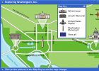
Interactive Map: Exploring Washington, D.C.
Suzanne Teesdale Organización
- 901 visitas
Interactive map to practise interpreting a street map and using cardinal points.
-

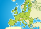
Interactive map of European Union
Suzanne Teesdale Organización
- 874 visitas
Interactive map of European Union that provides information about member countries.
-

blnak map and flag .pptx
teresa sanchez vivancos Docente
- 907 visitas
follow your teacher's instructions
-

Colorado River Map -- National Geographic
V&V Books Vicens Vives Organización
- 886 visitas
Explore an interactive map of Colorado River diversions, dams, ecosystems, stories, pictures, video, and more
-

Sky map and constellation game
Cristina Seco Organización
- 736 visitas
Check this constellation map and try to find the constellations in the night sky
-

organigrama del colegio - Mind Map
Johanna Paucar Guaman Estudiante
- 1 lo usan
- 506 visitas
organigrama
-

eduardo salazar gomez - Mind Map
gilbert arreaga Estudiante
- 1 lo usan
- 506 visitas
organigrama del colegio
-

2012 World Population Interactive Map
Cristina Seco Organización
- 471 visitas
An interactive world population map based on data from 2012. It allows zooming in on different regions and has options to select different categories, such as natural growth and life expectancy.
Te estamos redirigiendo a la ficha del libro...


